
Join the discussion
Write your take first — we'll ask for email only when you're ready to publish.
- Hacker News
- Just one little thing: East of Buena Vista Park, you have a lake, it is actually the road which goes around the park.
Also, I would love to zoom in more. (pls give me the pixels)
by flomo - more zoom enabled!by nuwandavek
- Spurious lakes are an interesting issue I looked into a bit. 2 types of cases ended up becoming lakes: 1. "shadows" 2. flat green areas
I think a better data distribution should eliminate this. Also, my "water detector" was not too good and could be improved.
I wrote about a few of these things here: https://sf.isopolis.city/dev.html
by nuwandavek - Amazing, great project. The SV show music playing on opening was such a good detail to add, loved it!
Thank you for putting this together. Brought some fun memories back from my time living in SF
by nico - Would be extra awesome if there was a navigation app that used this mapby qurren
- I'm reminded of the wonderful https://cannoneyed.com/projects/isometric-nyc project, also previously discussed here: https://news.ycombinator.com/item?id=46721802
This could be a great anecdotal benchmark for agent/model progress. I wonder how much easier things have gotten with the latest Codex/Claude vs. when isometric.nyc was made.
by wxw - This is really cool, it gives me SimCity 2000 vibes. I like that I can click on neighborhoods and regions and get more information about them!by accrual
- Those who know game dev know making good isometric maps can be deceptively difficult. You grabbed that bull by the horns and did so beautifully. Well done!by jtfrench
- ty!by nuwandavek
- This is incredibly beautiful. A few months back I tried to build a my own version of Google Earth rendered in voxels. Basically building from the terrain heightmaps scans available in open public data. Making it smooth and tessellation to work was incredible amount of work even for a simple vexed renderer https://codetiger.in/earth/by codetiger
- Nice, but not sure I agree with your use of voxels. It appears more like pixelated height map, not the use of 3d pixels. From what I see every position on the globe can only have a single elevationby tda
- Nice! But for a city renowned for its steep streets, this looks suspiciously flat :) Ok, you could say it's only a 3D rendering of a 2D map, and it probably has to be this way for practical reasons, to avoid hills obscuring objects behind them, because you can't rotate the map as far as I can see, but not seeing actual height represented in a 3D view still takes some getting used to.
Also, there are neighbourhoods and landmarks, but not actual street names as far as I can see? Not to mention transit stops/lines and other fancy stuff one could add...
by rob74 - from his dev blog: "All map math happens in a single fixed ... plane... The intended effect was a classic Sim City view of the city. "by RugnirViking
- It's vibe coded. LLM's have a hard time understanding elevation and isometric display.by sgt
- Incredible. It's easy to just go on browsing and exploring. The massive, scrollable pixel art aspect reminds me a little of Floor796: https://floor796.com/by murphyslab
- This is amazing, it got everything I could think of but not all, where’s little nightmares, silent hill, naruto, men in black, for a starter. But it’s neat regardless!by tamimio
- https://arstechnica.com/science/2018/04/these-oblique-satell...
"Satellite images from highly oblique angles are pretty mindblowing"
If u like this u will like that
by EZ-Cheeze - woahhh, these are so beautiful!by nuwandavek
- Honest opinion: Really charming on first look, but nothing where you can get lost in the details, because once you look closer, the soullessness of the generated imagery comes through. So I spent about 5 minutes looking at it, then moved on, and likely won't ever go back there. With other things, like Floor796 that other people pointed out, I can spend so much time looking at all the labor of love that went in there, but making something to look at too closely likely wasn't the point here.by karpour
- I was thinking the same..in fact it made me think enough that I wrote a blog/rant article about the topic AND created then a HN account. Well not this one specifically but all the other projects together I have seen recently and I just happened to have time today https://burnoutdv.bearblog.dev/the-golden-age-of-hobbyiest-p...by burnoutdv
- Ouch, this seems unnecessarily harsh for a side project made for fun. This might be acceptable if this was a low effort single prompt to an AI but it’s pretty clear from the write up that that is far from the case.
FWIW I thought this was really cool.
by johnfn - For context, Floor796: https://floor796.com/
Note that clicking the characters shows extra information.
Protip, visit About -> FAQ; there are many interesting questions like “What interactive elements are there?”.
Previously discussed: https://news.ycombinator.com/item?id=46401612 (and others).
by thih9 - Behind the scenes stuff:
https://sf.isopolis.city/dev.html
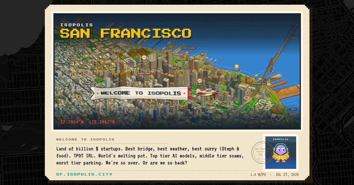
> The source is Google Photorealistic 3D Tiles. Isometric.nyc explored and rejected the use of 3d building data. It is pretty insane that US gov has free LIDAR data for every city in the US available to the public. I spent <30mins exploring this and stuck to google 3d images. Claude Code whipped up a scraper to stream the 3D Tiles and render with three.js. This gives the best "real" texture base for the model to learn from. Anything else would involve a LOT of manual work to get the inputs right.
> Now that we have the 3D tiles, we need to generate the ground truth pairs for training! Similar to isometric.nyc, I generated a few ghibli-style pixel-art images using Google's Nano Banana. SF terrain is very interesting. There are quite a few distinct features like skyscrapers in FiDi, the hills in the southeast, 2 iconic bridges, lots of coastline, piers, parks, suburban grids and lots of water. I generated a ton of images and curated from them. Getting consistent style was a challenge. There was a LOT of manual trial and error. But as usual, Claude Code added this feature to the dev app that allowed me to select the best images and approve them.
by lawrencechen - Really cool stuffby pcpliu
- interesting with the alcatraz island - I notice its invented some houses, and turned a cruise ship into a rock. I appreciate the difficulty and getting a lora to understand it - despite this the finished project is beautiful
I also feel that some of the technical explanations are a little dense here in the dev blog. I forget who it was who I saw mentioning it here on HN, but I've been having a lot of success with getting models to (re)write technical explanations in https://en.wikipedia.org/wiki/Simplified_Technical_English
by RugnirViking - glad you liked it!
I had to leave out a ton of details in the training process. But at every step, codex/cc built me a dev tool to navigate the complexity. That was such a unique side project experience.
by nuwandavek - > I'm stoked for the golden era of side-projects!
Love that attitude. Me too!
by simonw