Join the discussion
Write your take first — we'll ask for email only when you're ready to publish.
- Hacker News
- Not only should we be critical of how Israel wages this war, but we should also recognize the role of Hamas. Deliberate killing of non-combatants, civilian abductions, unguided rocket and mortar fire, use of human shields, perfidy and disguise, all war crimes and crimes against humanity.
Most of us here in the US don't have to worry about threats of terrorism like this. It doesn't excuse Israel's (many) war crimes but often we don't acknowledge the horror of Hamas on Israel and Palestinians when talking about this conflict.
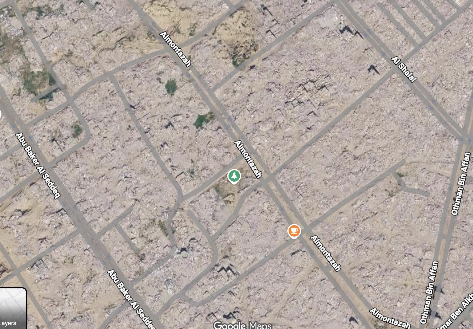
by gbriel - The icons from what was there before are a haunting digital ghost. School, Restaurant, Pharmacy all the city is just rubble.by wilburx3
- For comparison, here's Mosul in Iraq after the defeat of ISIS:
https://www.nytimes.com/interactive/2017/07/15/world/middlee...
https://www.bellingcat.com/news/middle-east/2016/11/01/battl...
https://www.huffpost.com/entry/mosul-satellite_n_596d34a3e4b...
by kpozin - If you want to compare before and after:
https://earth.google.com/web/search/31%2e297226,+34%2e243649... - then click "show historical imagery" next to the search box.
by neom - I suggest creating two tabs, one for Google Maps link [1] and another for Apple Maps link [2], then quickly switch between these two pages. It made me realize how much have been destroyed. Heart wrenching.
1. https://www.google.com/maps/@31.2963743,34.2449952,1665m
2. https://maps.apple.com/frame?map=satellite¢er=31.296508%...
by Alifatisk - "We are demolishing more and more homes, they have nowhere to return. The only obvious result will be the desire of the Gazans to emigrate outside the Strip. Our main problem is in the receiving countries."
—Benjamin Netanyahu, 2025
- There are Street View photos that look like they were taken from someone driving down one of the side streets so you can pretty much walk on it. You can see apartment buildings, local shops, people going about their day... It’s heart-wrenching to contrast that life with the current aerial view, with nothing but rubble and destruction.
https://www.google.com/maps/place/31%C2%B016'58.6%22N+34%C2%...
by fcortes - Its really telling to see the destruction limited to where the structures used to be rather than to all of the surrounding green spaces. If the destruction of civilian dwellings was purely an accident you'd expect to see the destruction spread evenly over the area. Instead it looks much more like a prolonged set of surgical strikes to destroy the buildings while preserving as much of the surrounding areas as possible.
For a great example of this, look at this pin https://maps.app.goo.gl/ZcMbdFcx87PrqoYNA
And here's a pin of where the farms were spared https://maps.app.goo.gl/iZbbTH4iH27FCz4s9
by bognition